TR
TR IT
IT
| Project | Cürek Miners’ Village Conservation-Oriented Landscape Design Proposal |
|---|---|
| Location | Divriği / Sivas (~ 30,5 ha) |
| Client | Sivas Governorship / Special Provincial Administration |
| Year | 2012 |
| Role | Landscape Architect / Consultant (ÇEKÜL) |
| Status | Preliminary design and evaluation report submitted |
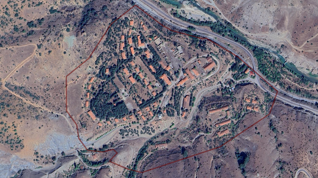
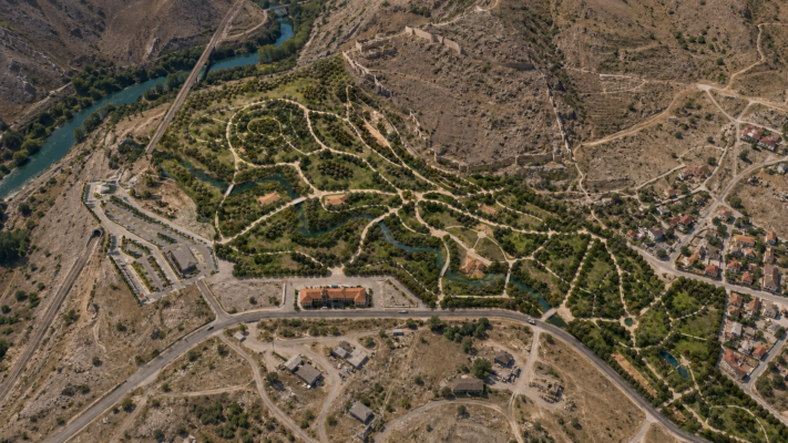
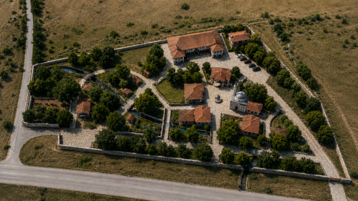
Cürek, located in the Divriği district of Sivas Province, represents an important example of the modernization movement undertaken in Türkiye during the Atatürk era. The Cürek settlement was constructed between 1939 and 1941 to provide workers, engineers, and administrative personnel employed at the Divriği iron mines, which commenced operations in 1938, with accommodation close to their workplaces. The settlement was designed to enable employees to live with their families in an environment that promoted occupational efficiency, social and cultural interaction, and a way of life integrated with nature.
The Cürek settlement was officially registered as a “Cultural Property Requiring Protection” by the Sivas Regional Conservation Council for Cultural and Natural Heritage of the Ministry of Culture of the Republic of Türkiye. The registration was made through Decision No. 431, dated 25 April 2007, adopted at Meeting No. 33 held on the same date, pursuant to Article 6 of the Law on the Conservation of Cultural and Natural Property No. 2883, as amended by Laws No. 3386 and No. 5226. In accordance with Principle Decision No. 660, dated 5 November 1999, the buildings were classified as Group II protected structures.
As a result of the technical inspection and assessment studies carried out on 24–25 November 2012, all 86 existing buildings were examined. Their conditions were documented through photographs, and the intervention techniques required for their repair were identified according to the extent of the damage.
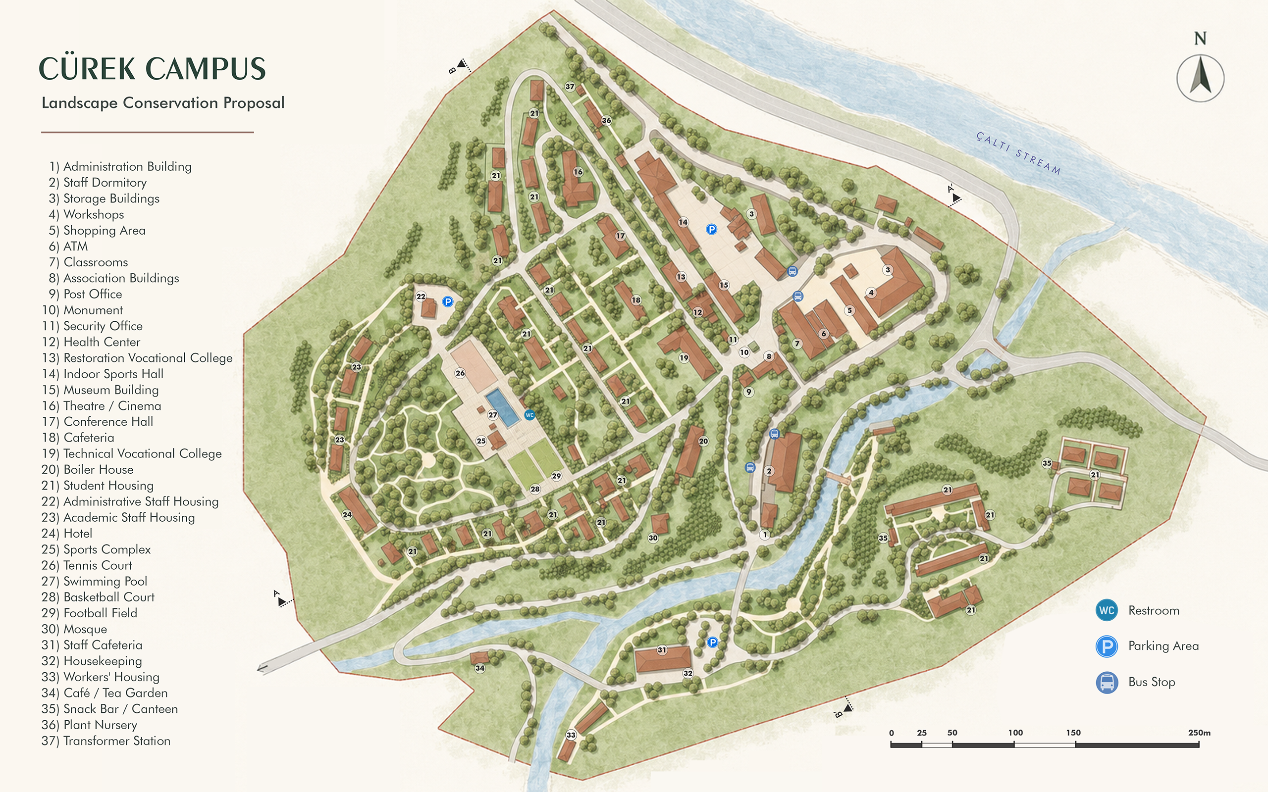
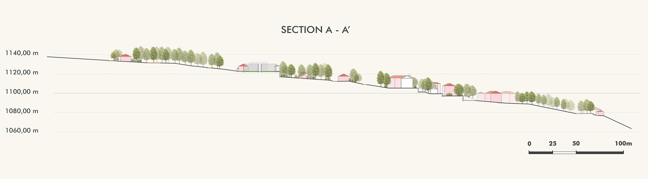
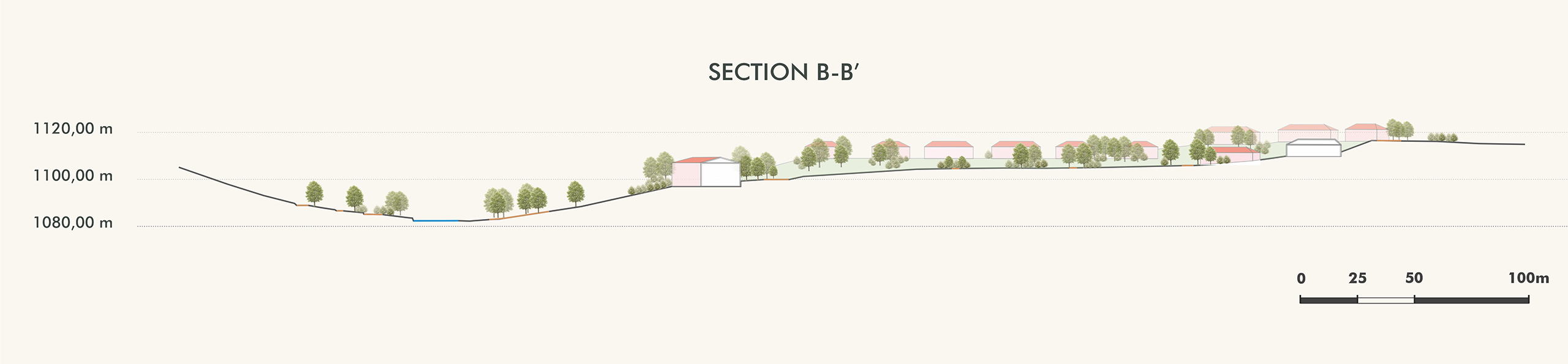
Since the Cürek settlement was established on sloping terrain, most of the buildings were positioned at different elevations separated by stone retaining walls and slopes and connected by concrete stairways. Behind most buildings, there are level green areas ranging from 3 to 12 metres in depth, bordered by jointed rubble-stone walls measuring between 1.5 and 3 metres in height or by steep slopes.
The side gardens contain one or more terraced levels formed by dry rubble-stone walls approximately 40–50 centimetres high. The front gardens consist of level green strips bordered by roads or by gently descending slopes leading towards the roads. Roadside planting was appropriately carried out using coniferous trees, while the gardens are covered with irregular groups of shrubs and ground-cover plants.
A large level area was created in the centre of the site to accommodate sports facilities and social amenities. Workshops and garages are located in another large open area at the lower elevations. Both areas are currently in a severely deteriorated condition.
The findings and recommendations concerning the existing landscape arrangement of the Cürek settlement are presented under the following headings:
• the topographical structure of the site
• the existing circulation network
• the surroundings of the buildings
• planting and vegetation
• irrigation and lighting